A Content Management System for Curating Earth View Images
For an entire decade, users have been able to take a virtual tour of the world using Google Earth. On its anniversary, Google expanded the image archive and made it accessible to the general public. Some 1,500 breathtaking images can now be viewed in various applications. The photos show coastlines with crystal clear water overlapping white sand and fields that look like gigantic patchwork quilts when viewed from above.
The beauty of the earth in 1,500 images
Google Earth was developed for companies and organizations in order to provide them with an up-to-date image of locations. An in-house team at Google ensures that the latest satellite images are available at all times. In order to thank the editorial team for its work on the occasion of the ten-year anniversary of Google Maps and once again share the beauty of our world, Google decided to put together a book of Earth View images – and hired Ubilabs for this task. From selecting the images and designing the book to printing it, we were responsible for producing Google Maps 10 in its entirety. The images were also included on the Google Earth website. Originally created as an “Easter egg” (i.e. a hidden function) Ubilabs selected additional Earth View images and included them on the world map.
Due to the overwhelming response, Google decided to select further high-quality satellite images and make them publicly accessible. In order to generate a large volume of images for the team, which was located on two continents, a content management system and a work ethic were needed.


Content management system enables global collaboration
With a simple but effective tool, Ubilabs ensured seamless collaboration among the various teams located in different time zones. Locations are found and marked using Google Maps. Next, they are evaluated and the best images are exported in high resolution.
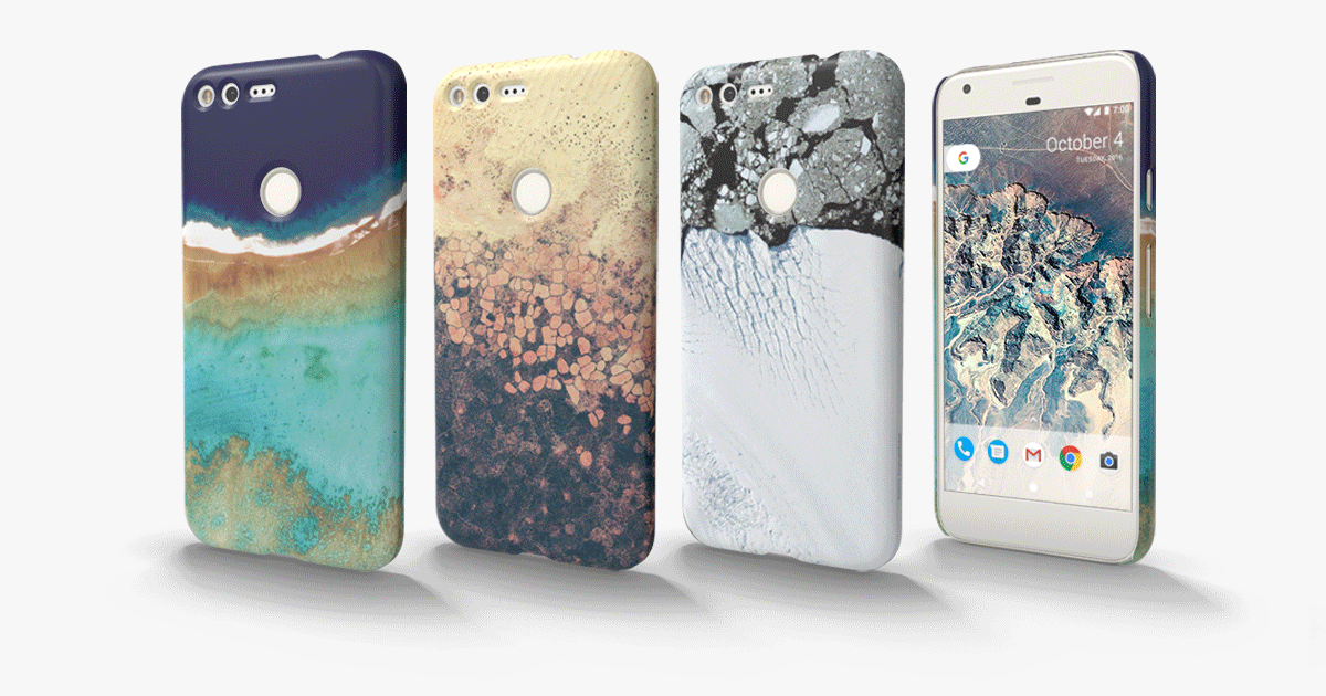
1,500 selected images were used as a Chromecast backdrop, which appears when a media-streaming device is connected. We also developed an online gallery and an extension for the Google Chrome browser in which a random image appears as the background whenever a new tab is opened. The images are also used as the background for Android Marshmallow, Google’s new operating system for smartphones and tablets. Images of coastlines, in which crystal clear water overlaps white sandy beaches, city views, and rugged snow-covered mountains can now be downloaded and shared free of charge.
Larger-than-life presence in Times Square
One highlight was when the satellite images were projected on a huge screen on New York’s Times Square in the run-up to Christmas. Eight stories tall and roughly the length of a soccer field, the digital ad covered the entire side of the Marriott Marquis Hotel. The images, which were shown for 30 seconds, invited viewers to take a moment and marvel at the uniqueness of our planet.
Experience Google Earth ViewAdds a beautiful sense in your everyday work life!